Antarctica and Patagonia, Chile – Wildlife

Puma

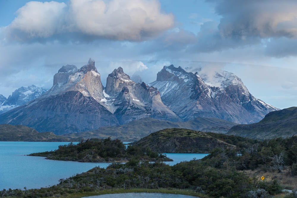
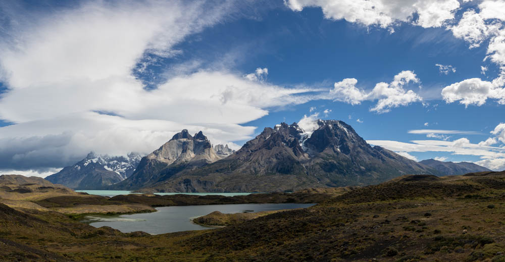
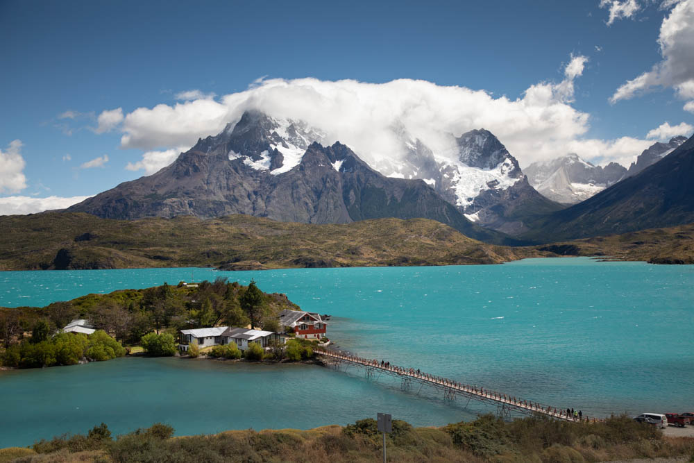
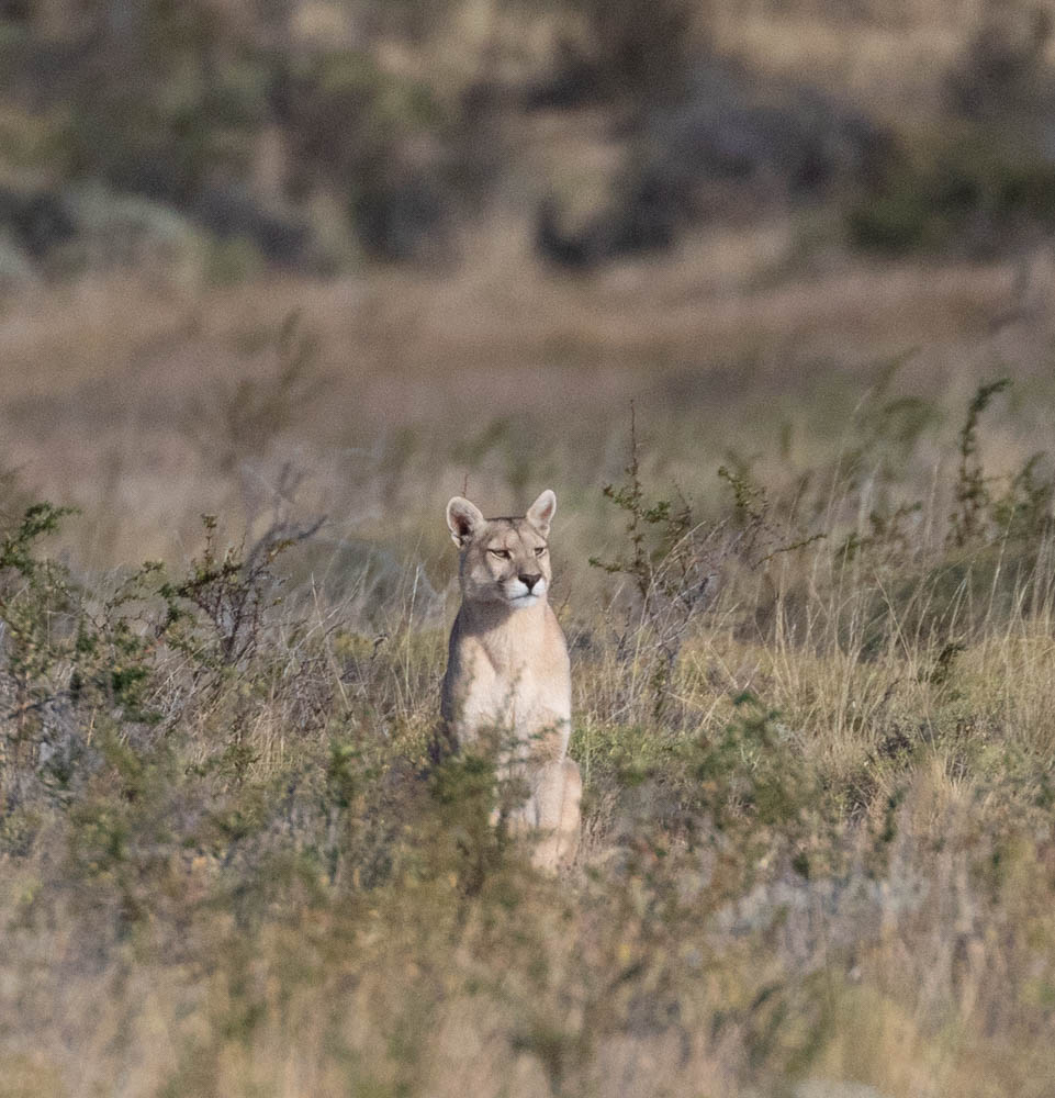
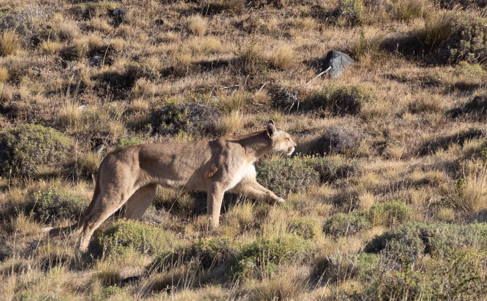
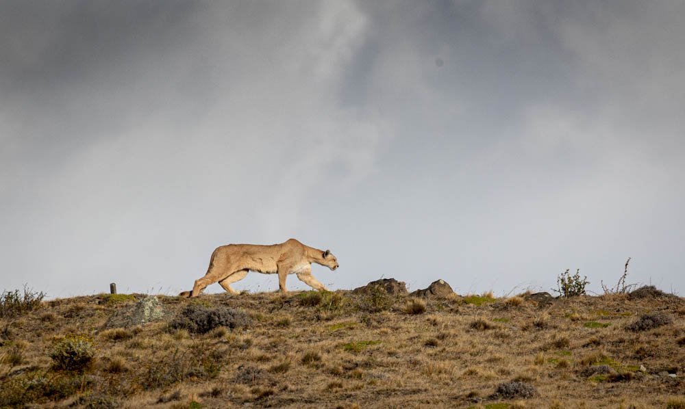
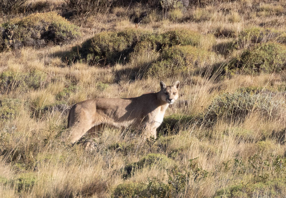
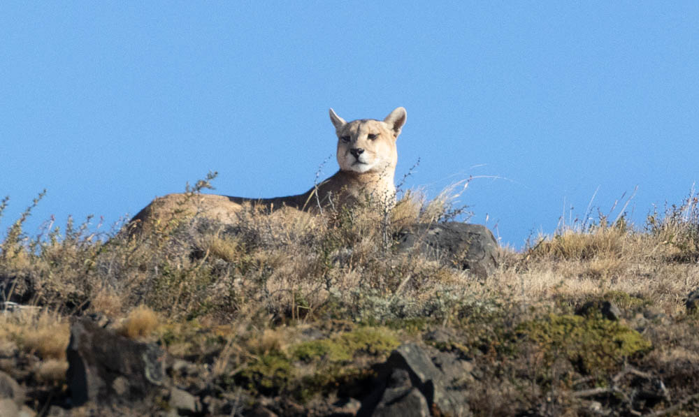
After shooting sunrises the first two days in and around Torres del Paine National Park, we went looking for puma before heading back to the hotel for breakfast. They are most active early in the morning and late in the day. Like many nocturnal wildlife, they tend to lay low during mid-day. We had our expert puma guide with us for those days. Puma, as they are called in South America, is what we call mountain lions in the Western United States from Texas to Canada. The only confirmed location in the East is in Florida where they are called panthers. They are also called cougars elsewhere. They hold the Guinness World Record for having the most names…about 40 in English alone….of any other living mammal. What they are called depends on their location.

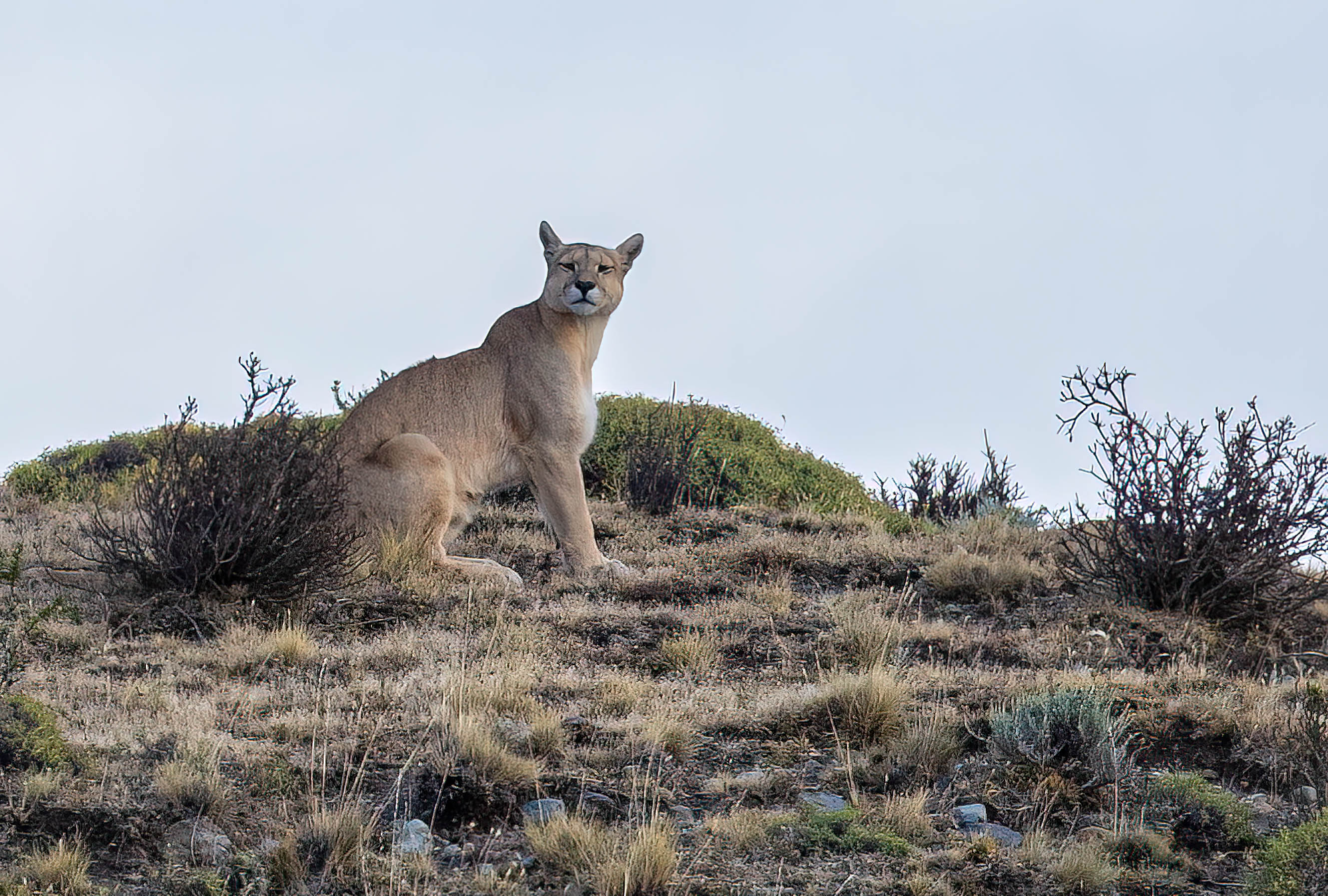
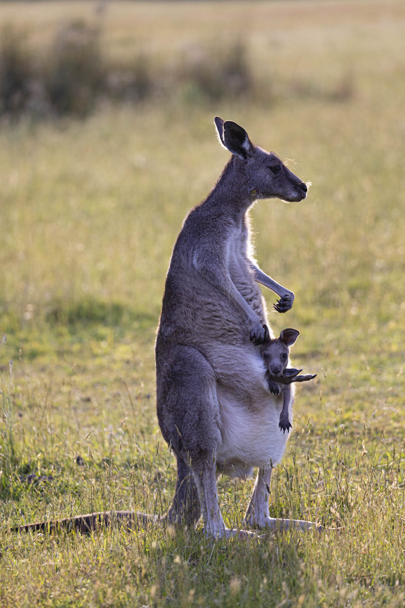
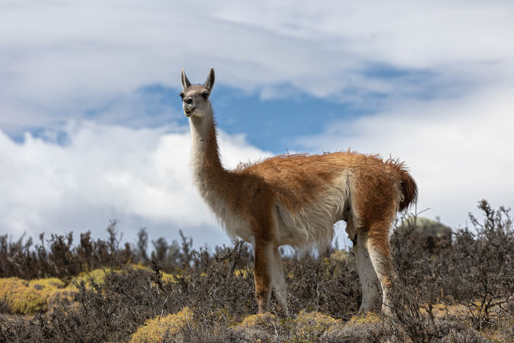
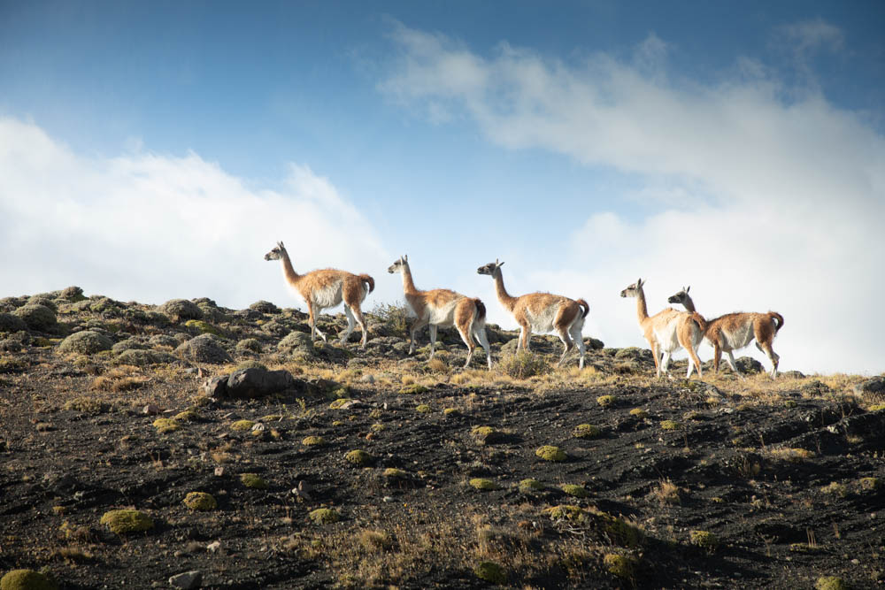
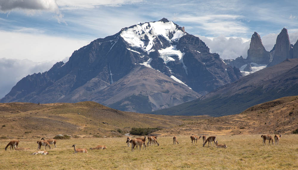
Pumas feast on llama, vicuna and alpaca along with pets, birds and various rodents. The guanaco is one of it’s main food sources. It’s a member of the camel and llama family. It’s also a relative of the vicuna in northern South America. The guanaco are generally approachable. If you walk up to them slowly they’ll usually let you get reasonable close.

Guanaco
A large group of guanaco grazing.

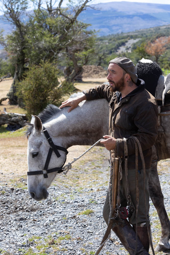
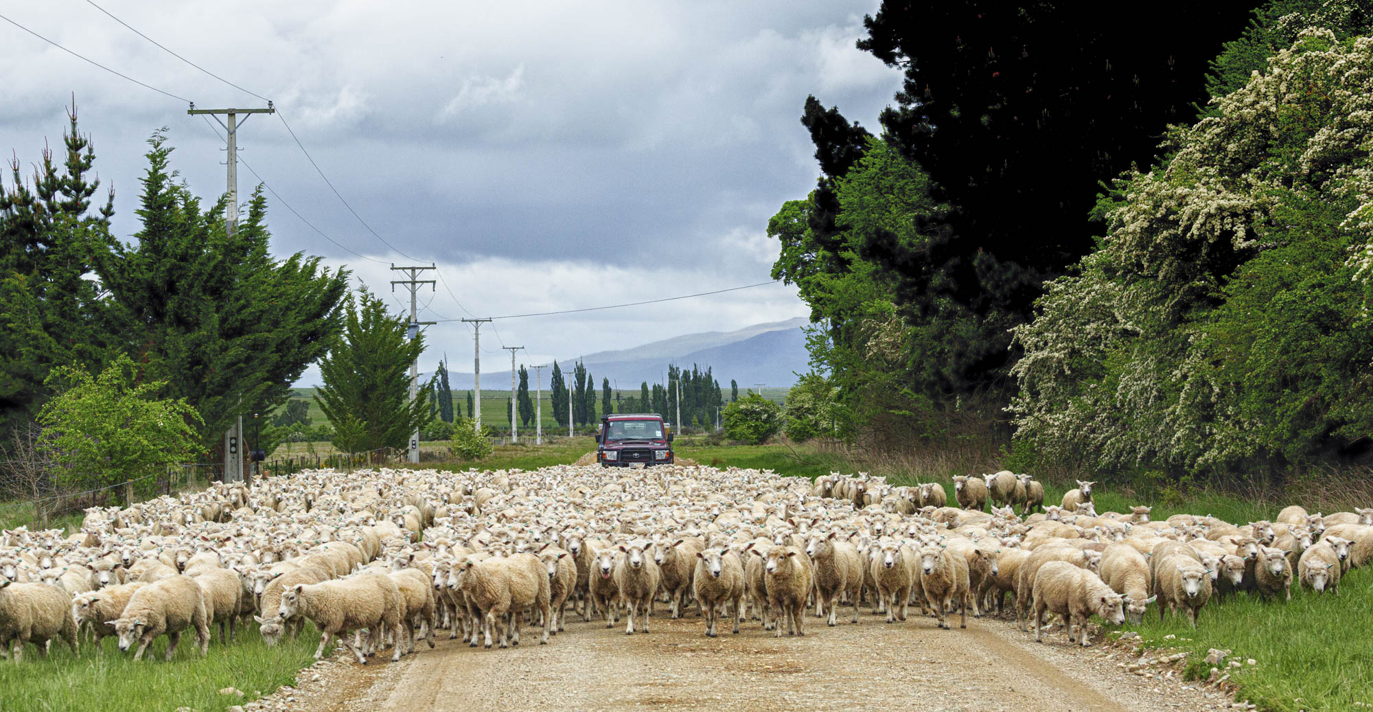
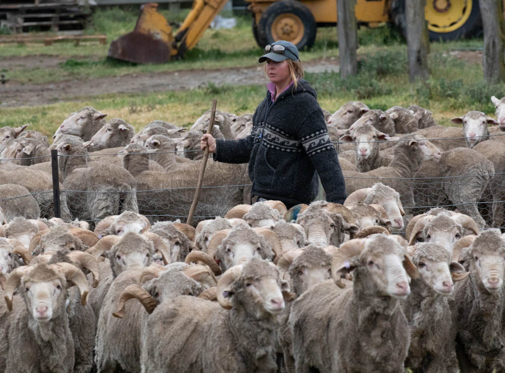
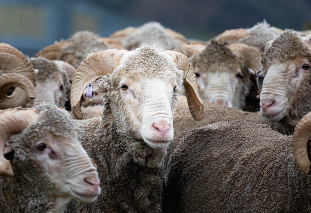
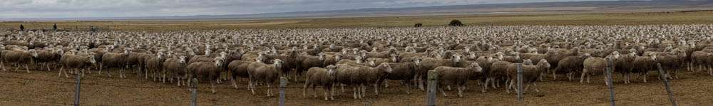
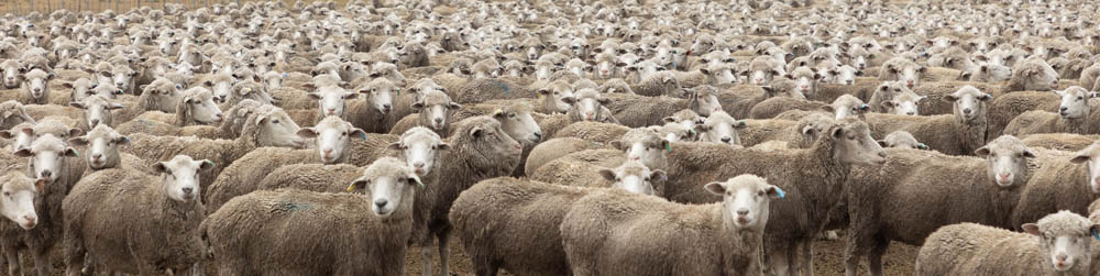
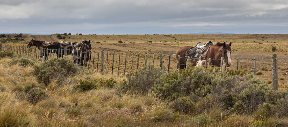
We also stumbled across this large corral full of sheep with the gaucho’s horses tied to a neighboring fence. These aren’t exacting wildlife but there sure is a lot of them here.

.

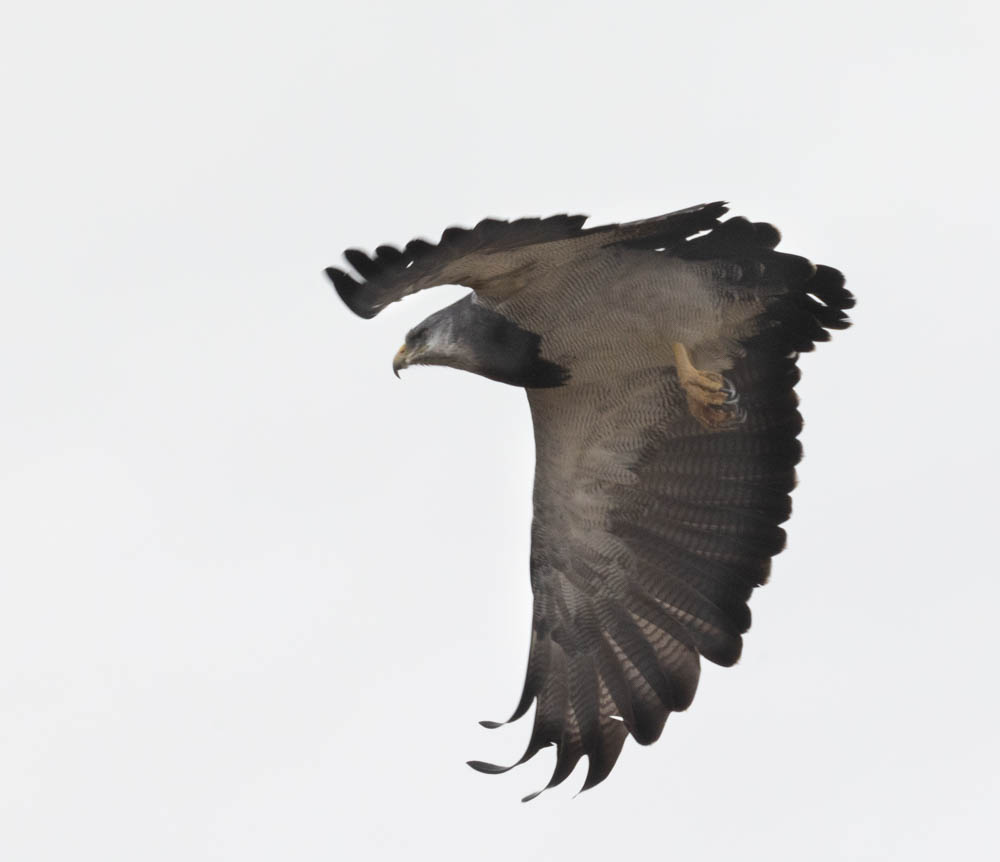
I got one image of a condor but it’s so high and far away that I’m not going to post it. You can’t tell if it has a ten foot wing span or a two foot wing span. (It has a 10-11 foot wing span.) I did get this black-breasted, buzzard eagle, though.

This black-breasted, buzzard eagle is part of the hawk family.

Lastly, while sitting in the van at a campground, this red fox zipped across the parking lot and headed for the woods.

It’s not a great image but it was a quick grab through the front window of the van.

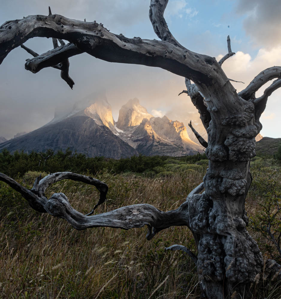
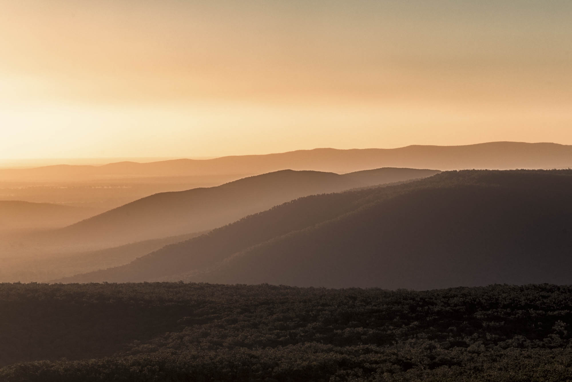
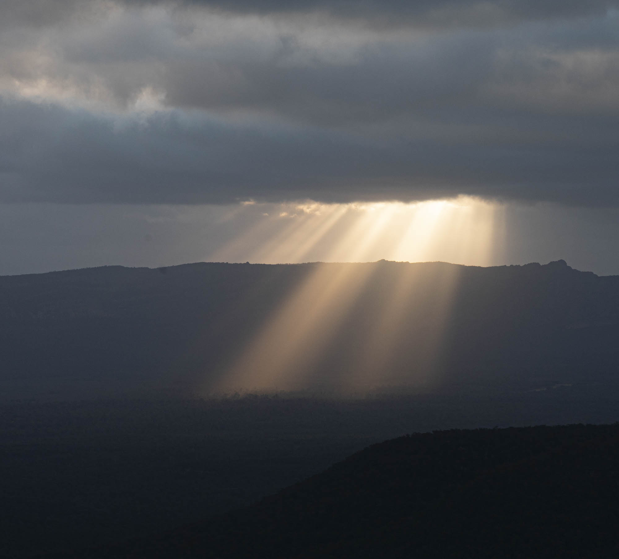
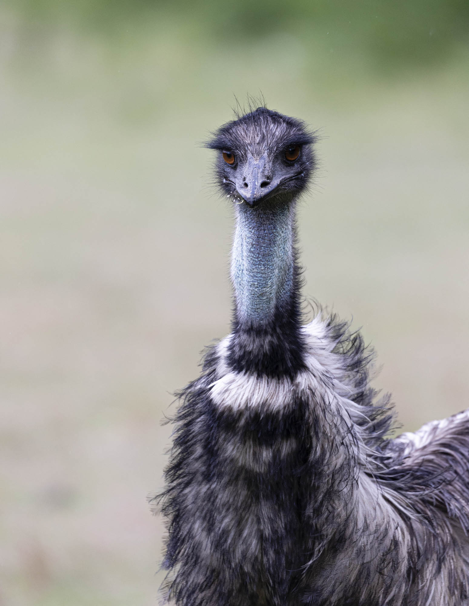
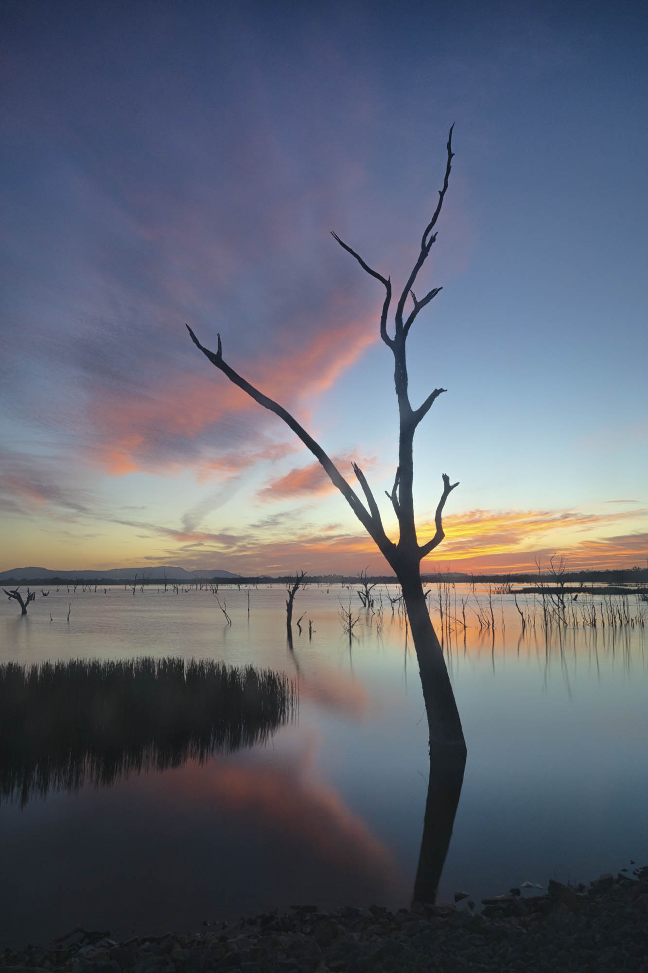
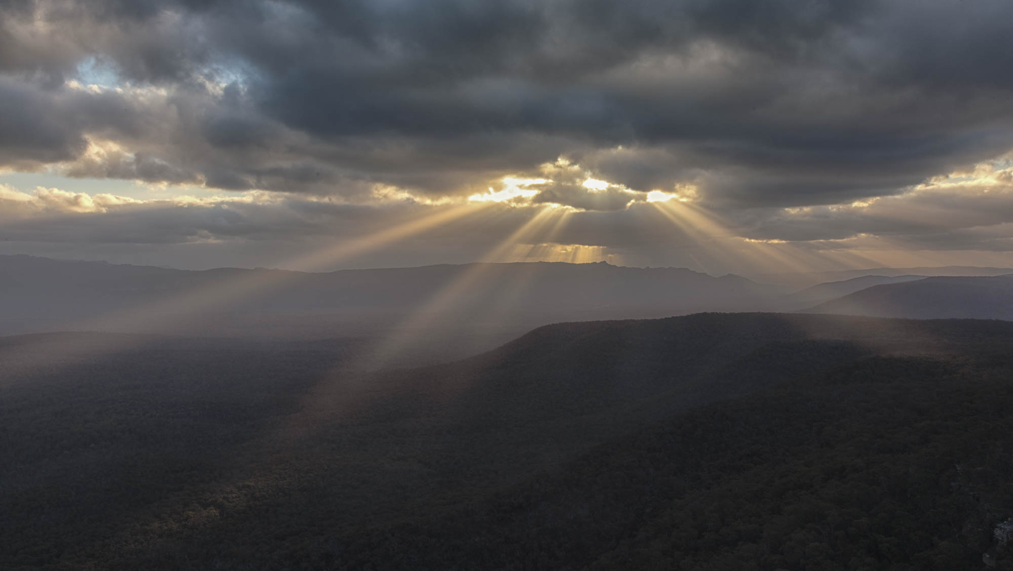
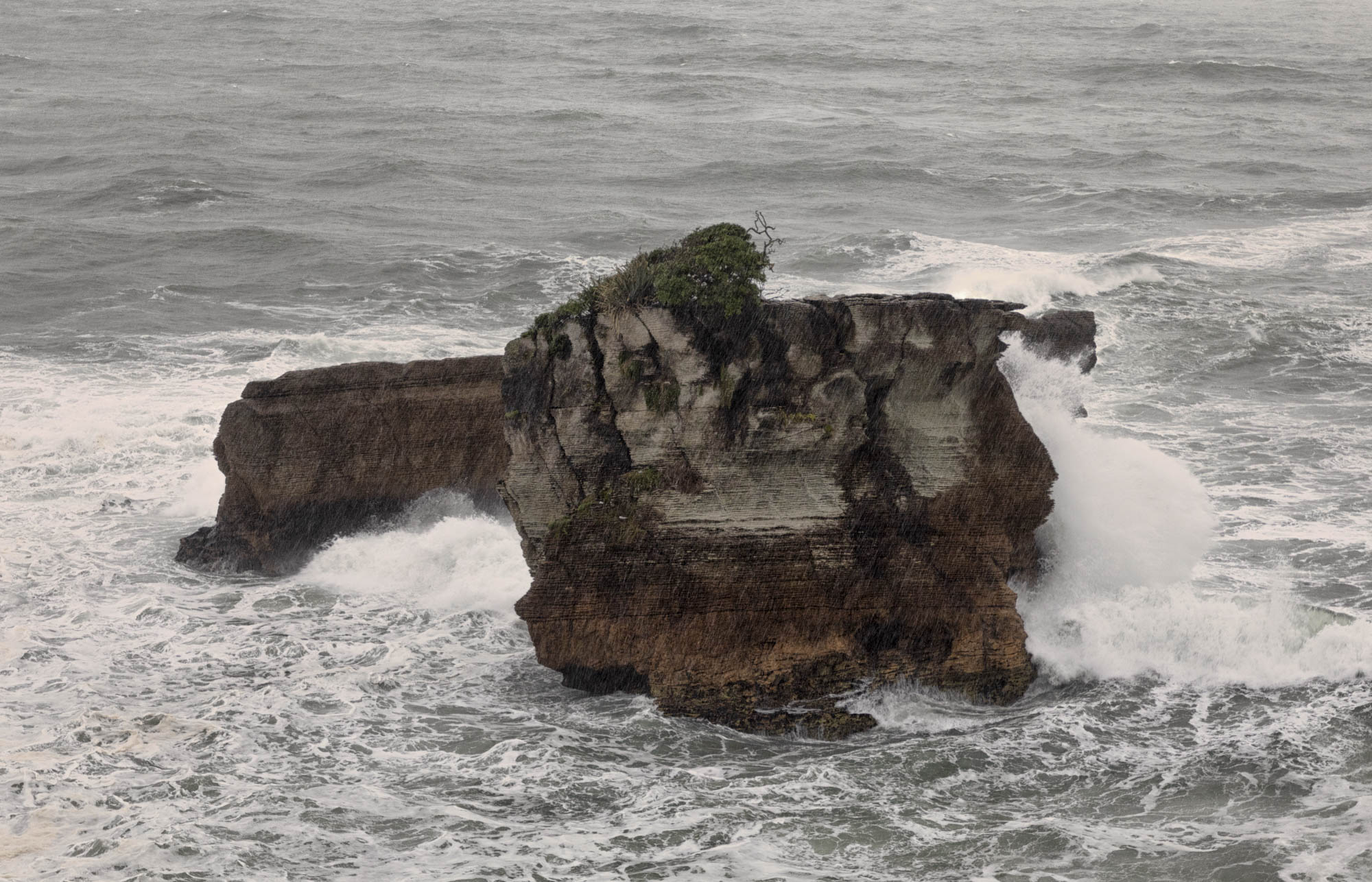
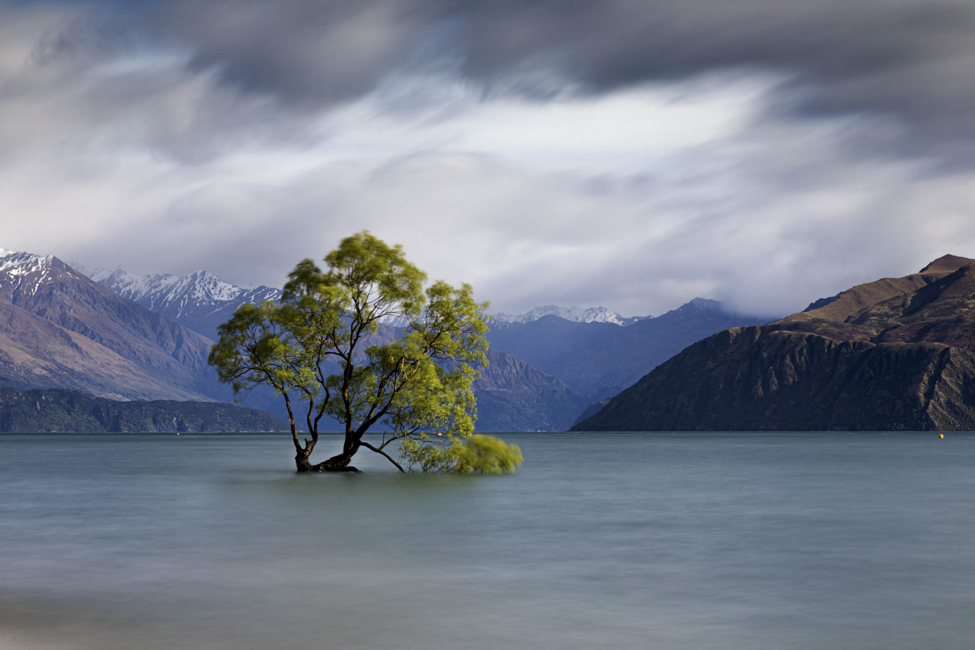
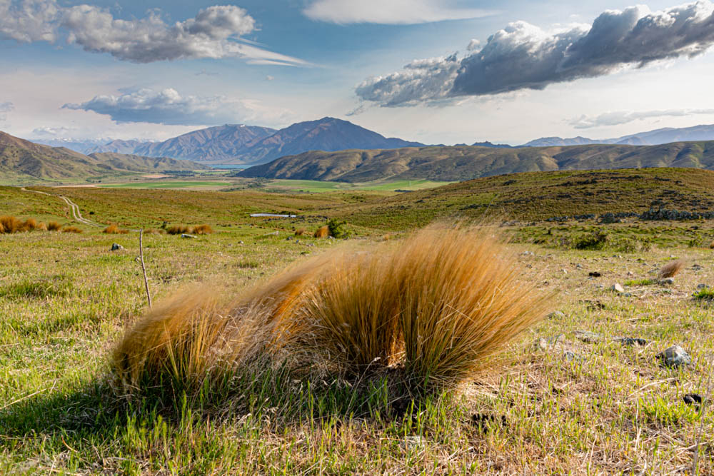
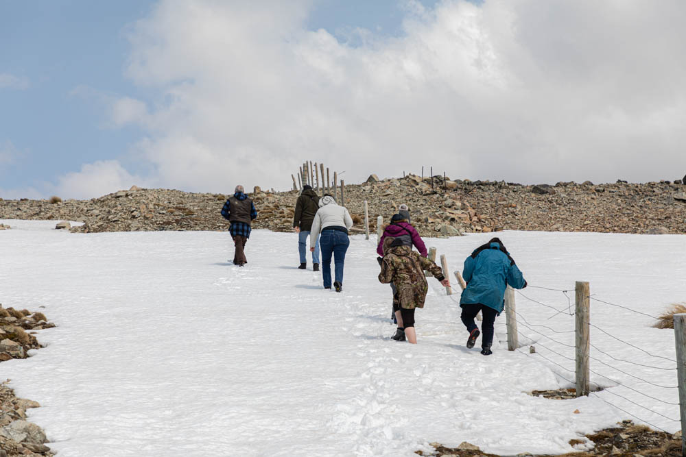
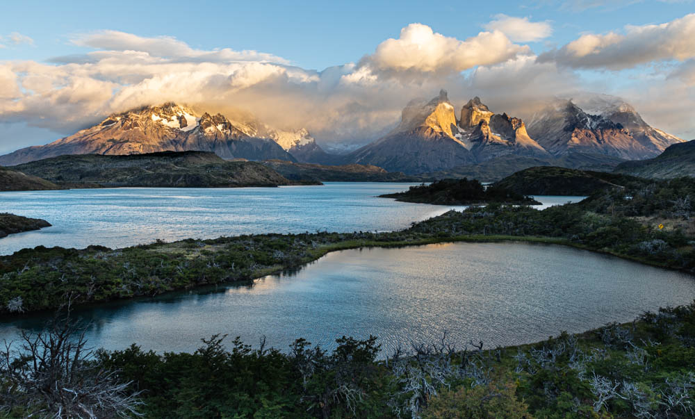
My final image from my trip is this one. This is also my last post from my trip to Antarctica and Patagonia, Chile.

Once again, thanks for following my blog!

Posted in Antarctica and Patagonia, Chile | Leave a comment

Antarctica and Patagonia, Chile – Seals and Icebergs

Weddell seal in the snow.

There are several kinds of seals in this part of the Antarctic. This one is a Weddell seal. I shot it at a low shutter speed to blur the snow. We made several zodiac landings at various points on the peninsula on the northwest corner of the continent south of Chile. This is summer in Antarctica. The weather ranged from snow and rain to generally overcast and cloudy weather with temperatures ranging from the mid-20’s to the mid-30’s. As it turned out, it was generally warmer in Antarctica than it was at home in Kansas at the time. That’s not true today! There are also some fur seals, crab seals and the penquins primary predator, the tiger seal.

Tiger Seal
Weddell seal baring his teeth.

While we did see a few seals in the water, most of them were on floating icebergs.

This is a crab seal.
Crab Seal
Weddell seal

I liked the landings but I’ve seen penquins and seals on previous trips. I certainly liked watching them move around the land and in the water. What I think I enjoyed most was the unique forms that the icebergs took. Without putting something in an image to give some scale to the size of an iceberg it’s difficult to realize how large they are. For example, this image of zodiac from our ship with an iceberg in the background.

A zodiac between two large icebergs.
A zodiac moving between two icebergs.
These icebergs are thirty to forty feet high. These are reflections and not the under-the-water portion of the icebergs.

It’s said that what you see above the surface is only a small part of the iceberg below the surface. This next image was of an iceberg that was right next to our ship one evening. Looking down on it shows all that is below the surface.

Some additional icebergs…..

This iceberg has a pool in the center of it.
You can see the iceberg below the surface.

Following are a few images I shot with a GoPro. I held it below the surface beside the zodiac on an approximately 24″ handle. Most of these images are of smaller icebergs that we floated up to on our zodiac.

The mountains were equally beautiful.

Entering the Lemaire Channel. This is a 12-image panorama.

The Lemaire Channel is a fairly narrow channel. It is only about 1600 yards wide. It is one of the first passages we made into Antarctica waters.

On a rare sunny day I could see the reflection of the mountains in the ocean.
This panorama is made up of nine images.
The kayak gives some scale to the size of the mountain.

There was a group of kayakers who went out most days to move around the icebergs and to make landings on shore. There was also a group of snorkelers in dry suits who floated on the ocean. One group of snorkelers had a whale pass under them. I’m sure that was exciting for them to see!

I wasn’t among either of these groups but I did do a polar plunge off the stern of the ship. Yes, the water was cold but getting out in the wind was colder! I’m still waiting on a picture that the ship’s photographer took of all of us who went in the water. There were about 20 polar plungers!

We also saw several whales but most were too distant for me to get good images.

At the conclusion of our cruise, we headed back north to King George Island at the northern tip of the peninsula. We had cruised from Punta Arenas, Chile to Antarctica but we flew back to Punta Arenas from King George Island. I was expecting a small airport but what we learned was that it was just an airstrip. We took zodiacs to shore. From there we had a mile and half walk up the hill to the airstrip. We passed between two research stations. One for Chile and another for Russia. Another Chinese one wasn’t too far away. There was no terminal, no seats, just a landing strip. Luckily, it was a beautiful sunny day. If it had been raining it would not have been pleasant. Three planes from Antarctic Airlines arrived. The red/blue group got on plane #1. Those of us in the yellow/green group boarded plane #2 and the three Covid patients boarded a third plane. We never saw them.

After arriving back in Punta Arenas, we spent the night in the same hotel we’d stay in at the beginning of our trip. The next morning I joined five others and our Russian guide, Daniel Kordan (his Americanized name) to start our week touring the Patagonian region of southern Chile. More on that in my next post. Thanks for following my blog!

Posted in Antarctica and Patagonia, Chile | Leave a comment

Antarctica and Patagonia, Chile – Sunrises and sunsets!

Patagonia is a region of South America that is located in the southern part of both Argentina and Chile. The largest part is in Argentina but there are 600,000 sq. miles in Chile with the Andes being the border between the two countries. After finishing my trip to Antarctica, I spent another week here with our guide, Daniel Kordan, and six other people. Five of us were on the Antarctica trip and the sixth, a Taiwanese young man, joined us for this part of the trip.

This was our group. Seven people, including our guide, with seven different nationalities. Pictured left to right is me kneeling, with Erik from Taiwan behind me, Daniel from Russia, Joaquin from Spain but now living in Austin, Ibrahim from Saudi Arabia, Michel from Canada and Deborah from the UK. Our driver, not pictured here, the eighth person in our group was from Chile. During the week, we had several other guides join us for a couple of days or less. One was our puma guide. More about him later.

The eastern part of Patagonia in Argentina is largely desert while the western portion in Chile is mountains, fiords, rivers and lakes. The primary point of interest is Torres del Paine National Park where we spent lot of our time. The Paine mastiffs are the most famous spires in the park.

The Paine towers are the three peaks in the center left of this image.

When you see a picture of Patagonia, the Torres del Paine towers are generally what you see.

An image of me on our last day picnic as I shot the previous image. Thanks Joaquin Delgado.

Punta Arenas was our starting and ending point for this trip. It’s a five hour drive south to the national park. We were up at 4:45 or earlier every morning for sunrise.

There was forest fires here several years ago and, therefore, there are a lot of dead trees to use as foreground images for our sunrise pictures. At the end of the day, we did the reverse. We’d have dinner then go looking for some place for a sunset image. We weren’t as successful with sunsets because there was a lot of overcast days and finding a good sunset was more of a challenge. We had several nights of thick, low cloud cover. We did find a few. This one with some wild horses.

After spending the early morning shooting sunrises, we generally went back to our hotel for breakfast and then most of us went back to bed for a couple of hours of nap time. After lunch, we’d spend time reviewing and critiquing images with our guide then we went looking for some other good daytime images. After sunset, we rarely got back to our hotel before 10:30 or 11pm. Then we were up again the next morning before 5am.

A double waterfall. It’s not Niagara Falls, Iquasu Falls on the Brazil/Argentine border or Victoria Falls in Africa.
A small hotel that you had to walk across the bridge to reach.

Most of the lakes were a deep green. They were created by melt from the glaciers. One afternoon a local gaucho, the owner of our hotel, and another guide, ran some horses along the shore for us to photograph with the mountains in the background.

In my next blog, I’ll show you some images of the wildlife our puma guide located.

Hope you are enjoying these posts!

Posted in Antarctica and Patagonia, Chile | Leave a comment

Antarctica and Patagonia, Chile

Chinstrap Penquin in a snowstorm

I’ve recently returned from a trip to Antarctica and the Patagonia region of southern Chile. This is my first trip since my round-the-world trip in late 2019 and traveling has certainly changed. After filling out multiple forms for the Chilean Ministry of Health regarding my vaccination status and verifying the type and date of my three vaccinations, I got the okay to go to Chile.

I was required to have a PCR test within 72 hours of departing the United States. Originally, I was scheduled to leave Kansas City on Sunday, January 16. I got a PCR test at our nearest community health department on Thursday, January 13. It was negative. I wasn’t sure whether the 72 hours was from the date of the test or the date I got my results so I scheduled another test the next day at our local hospital. Another negative test. Meanwhile, my flights were cancelled on Saturday due to weather in Atlanta, my connecting airport. Delta rebooked my flights for Monday. When I arrived at the airport about three hours early, Delta refused my test because I wouldn’t be departing the US within the 72 hours from the time the test was administered. They sent me to an Urgent Care location about ten minutes from the airport for an antigen test. Got it…negative…and headed back to the airport. All good.

I had a two hour connection in Santiago, Chile for my final destination, Punta Arenas, Chile but I was required to get another another PCR test at the Santiago airport. Everyone arriving in Chile is required to get this test. Transiting the Santiago airport and going through the necessary procedures was difficult. Lines were long and even though I got pushed to the head of the PCR test line, I couldn’t make it fast enough. I missed the connection and was booked on a later flight that day. Most of my fellow travelers on my trip required 3 1/2 to 4 hours to go through the required procedures.

The company I had booked my trip with had arranged for a hotel in Punta Arenas prior to boarding our ship for our trip to Antarctica. Before boarding, we were bused to the port were we were required to get another Covid-19 antigen test….negative again. Chile is one of the most vaccinated countries in the world and everyone wears masks. Getting into a restaurant requires your temperature being taken at the door, your name and phone number for contract tracing, if necessary, and be masked. Plus only two people are allowed to sit at a table.

Our ship, the Greg Mortimer, was built in 2019. It is owned by Aurora Expeditions and is named for the company founder. It’s a beautiful ship with two viewing platforms that come out of the bow on either side.

This ship holds 120 passengers and a crew of 95. There were only 76 passengers onboard for our trip. Due to Covid precautions, we were divided into four groups of 19 or so. Each assigned a color…red, blue, yellow, and green. The red/blue group ate together in the dining room first one day and then alternated with the yellow/green group the next. Masks were worn all the time with the exception of when we were in our cabins or in the dining room. The two groups very rarely were together. Otherwise, whether we were hiking or in zodiacs, we wore masks. Also, we were assigned table mates and ate with the same people every meal. There was no moving from table to table to meet and visit with others. Also, there was an empty chair between everyone. All food was served by the staff whether buffet for breakfast and lunch or a la carte at dinner. There was no helping yourself in the buffet line. The food was very good by the way! Everyone onboard was tested five times. After the first test, about 3 days into the cruise, three people tested positive and were confined to their cabins. I was tested a total of 10 times between my first test at the community clinic at home and my final test before I departed Chile for home on Feb. 4.

The ship moved multiple times as we cruised along the west coast of the Antarctic peninsula. We made numerous landings and used zodiacs among the icebergs. On shore the primary attraction was penquins…gentoo, chinstrap and adelie. Also ashore were fur seals, crab seals, Weddell seals and tiger seals.

Two gentoo penquins traveling along the penquin highway, the trail they make to move through the snow. Gentoo penquins have a white strip on the tops of their heads and an orange bills
Another penquin on the penquin highway.
A colony of adelies. They don’t have any white on top of their heads and black bills.
A chinstrap penquin in the snow. Note what appears to be a strap under the chin thus the name.
A mother chinstrap feeds her chick.
Penquins swim fast and jump in the water. Tiger seals are their primary predator.
This gentoo pops up out of the water!

We look at seals in my next post.

Thanks for following my blog.

2 Comments

Koalas and the Redwood Forest. RTW Blog 28

As I mentioned previously, I hadn’t seen a koala since arriving in Australia.  Yesterday I got some great shots of several.  I had to go to the Moonlit Sanctuary, though, to get them. 

And for an extra $20 Australian (about $13 US) I got to pet one.

After the visit to the Sanctuary, we stopped at three wineries for samples and one stop at a cheese shop to have a small sampler plate.  The wine was good but I preferred the cheese.

My friend, David McKern, has been carting me all around this part of Australia.  In three weeks you can see a large part of New Zealand but 12 days in Australia is like trying to see the US in 12 days.  It can’t be done.  But we’ve seen a lot.  We’ve been up and down the Great Ocean Road multiple times moving from one location to another and back again for sunrises and sunsets.  The same for the Grampions mountains northwest of the coast.  We’ve been up and down the mountains multiple times to different lookouts.

Lastly, today we visited the Redwood Forest in Yarras Rangas National Park a little more than an hour from David’s home.  There are 1476 redwoods here.  Not quite a John Muir location but who would have expected a redwood forest in Australia.

To wrap up this blog post, I decided to publish a short Australian/USA thesaurus.

What is:

AUSSIE                   USA

Give way        —      Yield

Take Away    —       Take out at a resaurant

Bonnet           ..        Car hood

Boot                —       Trunk

Windscreen   —       Windshield

Brekkie           —       Breakfast

Chippie          —        Carpenter

Sparky           —         Electrician

Powerpoint  —        Plug in, electrical outlet

And my favorite road sign…only seen once….

Traffic Calming Devices……Speed bumps.

I leave tomorrow, Monday, Dec. 9 from Melbourne at 11:30am. and arrive in Dallas at 12:5o pm…also on Monday.  Those are local times.  Actually, I leave here at 6:30pm Sunday night CST in the US and arrive in Dallas on Monday at 12:50 pm also CST.  I fly to Sydney, change planes, and then fly non-stop to Dallas.  I pick up one day crossing the International Date Line.

I get home Tuesday the 90th day since leaving Girard.  It’s hard to believe I’ve been on the road for three months.  There may be one more post after I get home.

Thanks for following the blog!

Ron

Posted in Round-the-World | 3 Comments

Three Days in the Mountains. RTW Blog #27

Halls Gap, Victoria, Australia is located in the Grampians, a mountain range about three and a half hours north and west of Melbourne.  Again, David had been here multiple times beginning as a youngster on trips with his parents.  We headed for many of the lookouts in the mountains and made plans to return to one location for sunset that evening and another for sunrise the next morning.  Sunset was about 8:20 and we got there early to stake out our location.

Lots of wind but not a great sunset.  Sunset the second night was better with some great sun rays but the low clouds didn’t give us much of a look at the sun or the color in the clouds we were hoping for.

Sunrise the next morning meant we were up at 4:00. and all we got was fog.  All I was able to get was these trees in the fog near the lookout.

We’re staying in a campground just outside of Halls Gap.  We have a great three bedroom cabin with a large open field behind it.  Each morning there are many kangaroos hanging out here and many have a joey in their pouch.

I caught of couple starting their day with their kick boxing exercises!

These are the first kangaroos I’ve seen on the trip and they are plentiful around the campground, in town and, like deer in southeast Kansas, along the roads.

There are also a number of emu here.  They look a lot like ostrichs but smaller.

We slept in ‘til 4:40 for our second sunrise and went to a new location along the shores of Lake Fyans (pron. “fines”).  It was our best so far.  The dead trees in the lake made a very good foreground and, in my opinion, made the sunrise a success.

Here are two images from the same series.  Tell me which one you like best.

#1                                                #2

David promised me we’d see several animal found in Australia, kangaroos, wallabies, wombats, platypus and koalas.  We haven’t seen the platypus and koalas yet and we had to go to the Halls Gap zoo to see the wombats.  These little creatures are about the size of a small pig but heavier with sharp claws and teeth.

I did get an image of a rare white kangaroo at the zoo and saw a bluebird next to one of the pens.

How long does it take to play a game of cricket?  I’ll tell you in my next blog.  I think you’ll be surprised!

Ron


Posted in Round-the-World | 1 Comment

Welcome to Australia! RTW Post #26

Welcome to Australia!  I arrived early on Wednesday, Nov. 27 and was met at Melbourne airport by my friend, David McKern.  David and I had been roommates on my Iceland trip a year ago.  Melbourne is a city of more than 4.5 million and growing.  We spent most of the first day getting organized and then headed to the coast southeast of the city to shoot our first sunset.

The following two days were spent exploring places along that coast on day trips.

It was on one of these day trips that I thought I spotted my first kangaroo.

It was a wallaby, not a kangaroo.  Wallabies are smaller but look very similar to a kangaroo.

At one roadside park, we saw cockatoos.

Some rosellas.

A kookaburra later at a botanical garden..

Saturday, we left Melbourne for the coast southwest of the city.  This is an area that features The Great Ocean Road.

One of the best known sites along this highway is the 12 Apostles.

A group of sandstone rock formations just offshore.  There used to be 12.  Now there’s just 7 remaining.

But there are lots of others to explore along with awesome beaches.  We experienced winds gusting to about 50 knots along the coast with normal winds averaging 25-30 knots.

David has photographed this area extensively and took me to all the popular tourist spots as well as a number of his secret locations.  We frequently went back to a location for sunrise or sunset.  There are tracks the tourists use and we used them too.

and there are trails that David led me to and not many tourists can find.

One location, known as the Bakers Oven, is a rock formation we visited the first evening.

Later, he showed me a picture someone had taken with water coming through the opening.  We figured that it had to be during high tide and the next one was about 1pm the next afternoon.  We made plans to go back.  There was a lot of wave action from the high winds but only a trickle of water through the opening.

The next high tide…supposedly a larger high tide… was a 3am the next morning.  We made plans to go back and then stay up to shoot a sunrise.

It was pitch black when we got to the spot but only a small amount of water was coming through the hole.  We continued visiting many other rock formations along this section of highway.

On the third day, we went back to Bakers Oven one more time to consider it for that night’s sunset location and the water was pouring through the opening.  I finally got my shot!

After three nights in Port Campbell, we headed northwest to Halls Gap in the Grampion mountains.  That’s where we’ll pick up the story in my next blog.

Posted in Round-the-World | 3 Comments

Northwest Through Arthur’s Pass – RTW Blog Post #25

We had a little excitement, Southeast Kansas style, last Monday in Christchurch.  A tornado hit about 3-5 miles from where we were staying.  We heard a loud noise and the wind starting blowing quite strongly.  We found out later that a tornado had killed two people from flying debris not far from us.  A grill got blown across the patio and a propane bottle was blown over but no other damage.

We left Tuesday morning heading northwest across New Zealand’s South Island.  The entire spine of New Zealand from the North Island through the South Island is the Southern Alps as they’re called.  We were headed through Arthur’s Pass.


Our goal was Paparoa National Park midway between Greymouth and Westport on the west coast.  Specifically, we were headed to the Pancake Rocks.  We found a three bedroom cottage about a mile down the road from them.

The first look here was Tuesday afternoon and it was raining pretty hard.  We covered up our cameras and made the best of it.

The next morning the sun was trying to come out and we were able to put our tripods down and shoot some slow shutter speed blurred water shots before the rain started up again.  And ‘no”, I don’t know why they’re called the Pancake Rocks.

The last image is of one of the blowholes in the rocks.

Wednesday night was spent with Toni’s brother at his home on the northeast corner of the South Island near our ferry location in Picton.  On Thursday we made the three and a half hour ferry trip back to the North Island.  We were lucky on both of our trips on the ferry.  It was a extremely calm sail across the Tasman Sea.

After a repeat visit with David’s friends, Chris and Jackie, we headed back to David’s on Friday.

Tuesday I fly from Tauranga to Auckland for one night before catching a 6am flight to Melbourne, Australia to meet another David, a roommate from my Iceland trip a year ago.

More from Australia in my next post.


Posted in Round-the-World | 2 Comments

Seeing the bottom of New Zealand! Blog Post #24

After leaving Otematata Sheep Station last Monday, David and I headed south through the Dansey Pass on our way to Cromwell.  As we came over a small rise, we were met by a flock of sheep being driven north.  (Just a warning, clicking on these images may seriously improve the quality of what you see.  Click at your own risk!)

We stopped the car and let the sheep work their way around us.

From our B&B in Cromwell, we headed north to photograph three popular New Zealand sites:  Mt. Cook, New Zealands highest mountain,

The Church of the Good Shepherd, a popular tourist location that is usually a favorite for the bus tours.

and, eventually, the Wanaka Tree.

David and I sat for about an hour on the shore of a river next to the church trying to get a shot that wasn’t crawling with tourists.  We got close but there’s still one guy standing there.

Then we moved on to Wanaka to photograph another famous location, the Wanaka Tree.  This willow sits in Lake Wanaka about 50 feet from shore.  You don’t usually have to fight a crowd of tourists around the tree but there are usually a number of photographers vying for a spot on the shore.  This morning wasn’t too bad.

Wednesday evening we met David’s wife, Toni, at the Queenstown airport.   She’s joining us for the rest of the trip.  After a night in a private, rural inn, The Nestledown, we headed into Fiordland National Park and Milford Sound.  It was a misty, foggy day but it seemed perfect for this family.

Despite the less than perfect weather, I was able to get some good images of the surrounding mountains.

Thursday night we stayed in a campground very similar to our KOA Campgrounds.  We each had a cabin.

Many others parked their rental campers all around us.

From Fiordland National Park, we headed south around the bottom of New Zealand to Bluff…the southern most tip of the country.

and on to Curio Bay, Tautuku Penisula and Nugget Point.  This area is known as the Catlins.

Winters here can be very windy and cold with strong winds, called the Roaring 40’s, blowing in from Anarctica.  Lots of trees end up looking like these.

There are lots of waterfalls with snowmelt filling the streams.

It’s been a week since leaving the sheep station and we’ve covered a lot of ground.   We’ve  made our way back to Christchurch again.  We’re taking a day to catch our breath and will leave tomorrow, Tuesday, for the northwest coast and eventually back to the North Island Friday or Saturday.

More later.


Posted in Round-the-World | 1 Comment

The Otematata Sheep Station…RTW Blog #23

I arrived in New Zealand on Monday, Nov. 4th and was met by my friend, David, who lives on the east side of the North Island.  This is David and Toni’s backyard.

After a day relaxing at their place, David and I left for the South Island.  That trip included a visit with David’s friends near the ferry terminal in Wellington.  It’s about a two hour ride from the North Island to the South Island and we were blessed with a very smooth ride.  We were going to spend the weekend of Nov. 8-11 at a working sheep shearing station called Otematata a couple of hours south and west of Christchurch with New Zealand professional photographer Scott Fowler.

Scott actually used to be a herder at this 104,000 acre sheep station.  Yes, that’s right….it’s 104,000 acres of mostly mountain.  We spent Friday and Sunday at a house near the base of the mountain and Saturday night we were at this hut…two bedrooms with bunk beds for five people in each and a kitchen/dining room (a picnic table with bench seats).

From here we loaded up into two 4-wheel drive vehicles to head to the top of the mountain at about 5,000 ft.  It was a rough but beautiful drive with a little excitement thrown in to keep things interesting. We were never in any danger of rolling but from inside it looked felt like we were.

At the top, Scott led our group the last 10-15 minutes to the top for a look down on the other side….1818 meters high.

We spent time shooting images around the main house  and some of the old buildings on the property near the base of the mountain

and watching one of the herders bring her flock of sheep…along with her dogs…into the paddocks.  These sheep will someday have their wool turned into merino sweaters.

The herder works with a flat whistle in her mouth and uses the dogs…each has specific jobs, some hunt out sheep in the mountains and others move the sheep around to where the herder wants them.  It was fascinating watching her maneuver them where she wanted them with just the dogs.

Also, got a chance to shoot a portrait of my friend at a window in one of the old buildings.

On Monday, we closed up camp and David and I headed south for another two weeks of photography.

We’ve been so busy traveling and photographing that I haven’t taken the time to post.  I’ll try to get caught up soon.

New Zealand is a beautiful country and David has told me several times that I’ve probably seen more of the country that many New Zealanders have.  David’s wife, Toni, joined us on Wednesday, Nov. 13, and together we’ve been on the move.

This is a country that is accessible to everyone and while the opportunity to work with professional photographer Scott Fowler has been a great learning experience for me, this is a place anyone of any age can come and see some fantastic landscapes.  I’d strongly suggest you add it to your bucket list!

More to come!


Posted in Round-the-World | Leave a comment